Spencer Morrissey
August 12, 2014
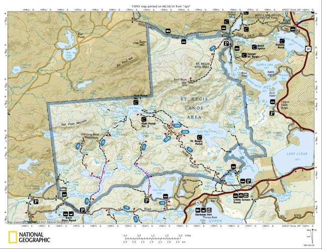
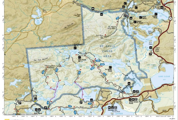
The Saint Regis Canoe Area is one of only a couple designated Canoe Areas in New York State. Located in Franklin County it spans three towns and over 18,400 Acres. The St. Regis Canoe Area includes St. Regis Mountain, St. Regis Pond, Long Pond, sections of the east and west branches of the St. Regis River, and 56 other water bodies, of course not all is perfect for paddling - or even feasible, but much of it is. With all that to choose from, I have chosen three outstanding locations for short paddles that are perfect for the entire family. There will be short portages needed to reach some of these destinations, but none of which are too strenuous.
One of the Adirondacks' most popular ponds!
Long Pond
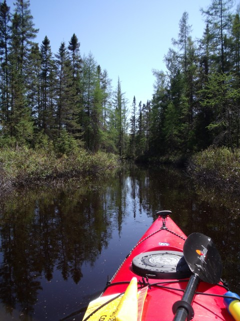
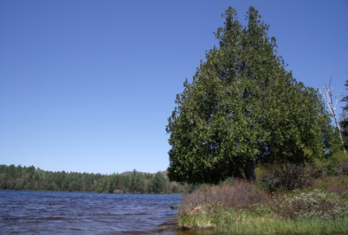
This paddle trip starts off with a short 0.25 mile portage on a slight downhill grade over a wide track. With nice footing even heavier boats are not too hard to handle on this short walk. Once at the put-in you will start to see the beauty of the Canoe Area. Long Pond is just that, very long, but it doesn’t flow in a perfect cardinal line from south to north. Long Pond is a broken cross-shaped pond with a bay on all four sides. While well sheltered, it does tend to get a bit of crosswind at times.
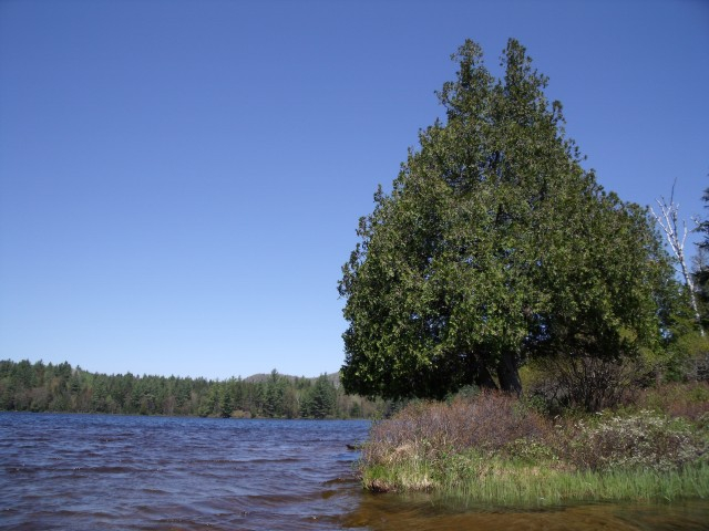
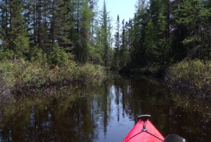
In the western bay is a hiking trail up Long Pond Mountain. Just to the north side of the southern bay (where you put in) is an outlet to Pink Ponds, this is an easy paddle to a rarely visited backcountry gem. In the western bay is a short carry to Slang Pond. In the northern bay is a trail to Nellie and Bessie Ponds, a bit of a long portage but a nice hike.
Where is Long Pond?
From the intersection of Route 3 and Route 86 in Saranac Lake follow Route 86 toward Paul Smiths. Continue for 5-miles to Route 186 on the left. Follow Route 186 for 4.0 miles to its end at Route 30. Follow Route 30 toward Tupper Lake for around 5.6 miles to Floodwood Road on the right. Follow Floodwood Road for 5.1 miles to the Long Pond Trail on the right where there is ample parking.
A destination for outstanding Adirondack Camping
Hoel Pond to Turtle Pond to Sang Pond
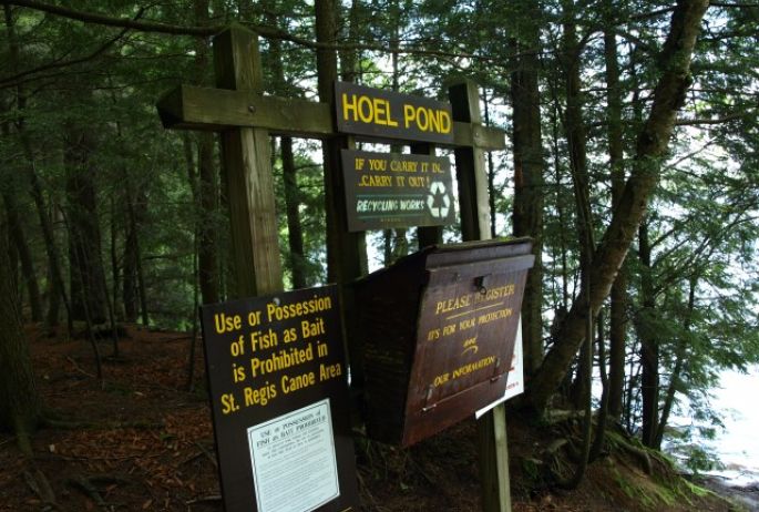
This route starts out from the state boat launch site at the south end of Hoel Pond. Hoel Pond is not located in the St. Regis Canoe Area, so don’t be surprised to see motorboats. Hoel Pond is a large pond with over 6-miles of shoreline to explore. The eastern shores are private, but camping sites are located on the pond to the NE and SW. To access Turtle Pond you will need to paddle 1-mile or so over open water. Hoel Pond is not well-sheltered from the winds and it can generate some serious white-caps if the weather is right. The short carry to Turtle Pond is at the railroad tracks at the north end of the pond. A culvert drains Hoel Pond and is not designed to travel through. There is an obvious gravel path that climbs steeply up and over the tracks to Turtle Pond on the other side, less than 100 feet total.
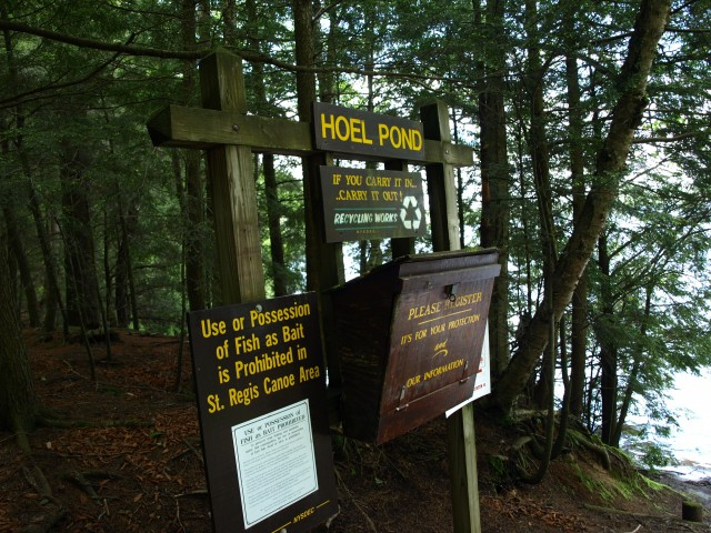
At Turtle Pond you will be in the Saint Regis Canoe Area, this is a very small pond, much quieter. A short paddle up this pond will quickly bring you to the narrows and onto Slang Pond. The narrows are an attractive spot in themselves. After some careful maneuvering through them you will be on Slang Pond, a most gorgeous destination with some fine camping.
Where is Hoel Pond?
From the intersection of Route 3 and Route 86 in Saranac Lake follow Route 86 toward Paul Smiths. Continue for 5-miles to Route 186 on the left. Follow Route 186 for 4-miles to its end at Route 30. Follow Route 30 toward Tupper Lake for around 5.5 miles to Floodwood Road on the right. Follow Floodwood Road for 0.35 miles to Hoel Pond Road on the right. Follow here to the Hoel Pond Access Road (dirt road) on the left. Follow this rough road along the golf course to the boat launch, 0.5 miles.
A Unique Paddling Experience
Little Clear Pond to Grass Pond
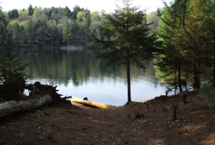
Little Clear Pond is also not in the Saint Regis Canoe Area, but acts as a gateway to the Canoe Area. Little Clear Pond is unique in the Adirondacks, in that, no fishing is allowed at all. The NYSDEC uses this pond for breeding for the fish hatchery. Little Clear Pond has a launch with no portaging required to reach the shore. It has two small islands on the western shore and a very large peninsula on the upper western shore. You will find the short carry to Grass Pond on the northeast shore. Once you leave Little Clear Pond you will be in the Saint Regis Canoe Area. Green Pond is entirely in the Canoe Area. At times the carry trail is a bit hard to find, but once you do, the trail is easy to follow.
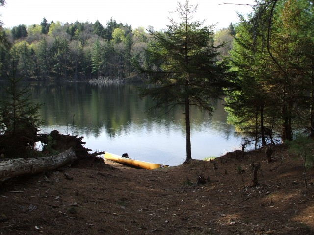
The carry is well hardened from years of use and is wide enough to carry any type of watercraft. The put in is on a sandy shore in the shallows. The paddle across and around the pond is very quick, but amazing. Plan to see local fisherman here on a regular basis. A nice campsite is located on the northern shore atop a small rise.
Where is Little Clear Pond?
From the intersection of Route 3 and Route 86 in Saranac Lake follow Route 86 toward Paul Smiths. Continue for 5-miles to Route 186 on the left. Follow Route 186 for 4-miles to its end at Route 30. Follow Route 30 toward Tupper Lake for just under 3-miles to Fish Hatchery Road on the right. Follow Fish Hatchery Road for 0.5 miles to the entrance to boat launch area. Follow this dirt road over the railroad tracks and straight to a Y-intersection. Take a right at the Y-intersection to the boat launch site.
Packages and Promotions
Valid Dec. 1
- Dec. 1
Valid Dec. 1
- Dec. 1
Linger Longer in Saranac Lake
Best Western Saranac Lake
Linger Longer in Saranac Lake at our supremely located property, Best Western Saranac Lake. Stay 2 nights or more and get 15% off!
Valid Jan. 16
- Mar. 31
Valid Jan. 16
- Mar. 31
Hotel Saranac Sled & Spoke Package
Hotel Saranac
Snowmobile Package Hotel Saranac and Sara-Placid Sled & Spoke have partnered so you and a guest can explore dozens of miles of ADK snowmobile...
Valid Jan. 16
- Mar. 31
Valid Jan. 16
- Mar. 31
Hotel Saranac Ski & Stay Package
Hotel Saranac
Stay & Ski Package Stay at Hotel Saranac and Ski Titus Mountain Day or Night Package Your room reservation includes one adult lift ticket....
Valid Jun. 20
- Sep. 7
Valid Mar. 12
- Jun. 30
Guided Nature Immersions - 10% off for Pre-Season Registration
Adirondack Riverwalking & Forest Bathing
Picture it now...you are wading the Ausable River on a warm summer day, feel the cool water against you, hear the sounds of the birds and the...
Valid Jan. 21
- Mar. 31
Valid Jan. 21
- Mar. 31
Titus Mountain Ski Package
Voco Saranac Lake
Enjoy your stay at the award winning voco Saranac Lake which includes two adult lift tickets at Titus Mountain Family Ski Center. Additional...
Valid Jan. 21
- Jan. 21
Valid Jan. 21
- Jan. 21
Stay and Dine
Voco Saranac Lake
Receive a 50 dollar credit per stay to use in our Boathouse Saranac Lake Pub. Enjoy an exceptional dining experience with unparalleled views great...

